


Addthis
Explanation about Data (Extracted from Elena Ojeda PhD Thesis)
The coastal system is in incessant change, subject to the constant action of waves and tides (in addition to the wind action) that shape its morphology. The mutual interaction and adjustment of the seafloor topography and the fluid dynamics involving the motion of sediment is known as coastal morphodynamics. This interrelation can be explained as follows: in the nearshore region the water motion is influenced by the seafloor topography and is responsible of sediment transport. Gradients in the sediment transport produce morphological changes in the seafloor. The loop is complete as hydrodynamic processes respond to the modified bathymetry.
The Argus program was started in 1992 by the Coastal Imaging Lab at Oregon State University. An extensive description of the system and its history can be found in Holman and Stanley (2007). A typical Argus station is composed of a number of video cameras placed at a certain height above sea level and pointing towards the coast. The cameras are connected to a host computer that controls the capture, storage, pre-processing and transfer of images to the database and to the Internet.
Video monitoring techniques give the possibility to study a range of spatial and temporal scales, from specific cross-shore profiles to several kilometres of coast and with sampling intervals depending on the required measurement. Moreover, this technique is not as conditioned by weather and wave state as traditional surveys. Standard cameras can sample every daylight hour, although during certain weather conditions (e.g., fog or heavy rain) the images may be not usable. However, video monitoring allows the collection of large quantities of images, and the acquisition of a series of hydrodynamic and topographic parameters.
The primary sampling technique is directed to obtain time-exposure images. This sampling is done every daylight hour during a ten-minute period (1 image per second). From the 600 images obtained, the system keeps three types of images (below): a snap shot, a time-exposure image (which contains the ten-minute average of the image intensity) and a variance image (which contains the standard deviation of the image intensity).
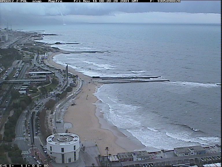 Snap shot (tornado)
|
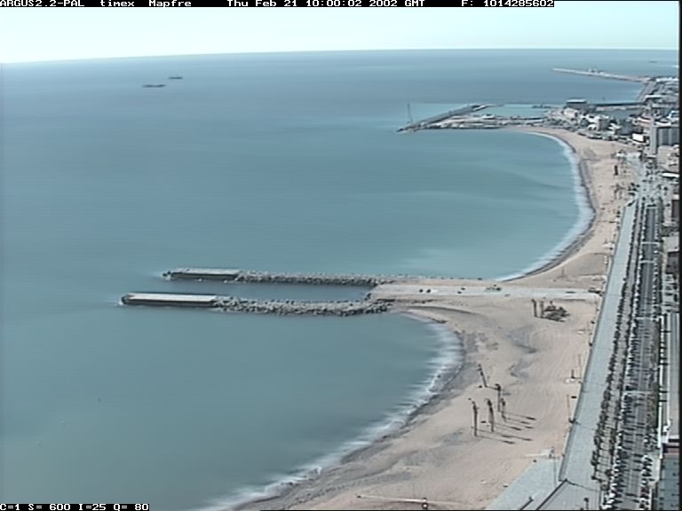 Timex
|
 Var
|
|
In order to obtain real-world coordinates from these oblique video images each camera must be calibrated, to remove the radial lens distortion, and the image must go through some geometrical transformation to find the relation between the image coordinates and the real-world locations.
 Pattern to calibrate camera
|
The process is described with detail in Holland et al. (1997). Once the images of the different cameras are rectified, they can be merged to obtain a plan view of the area (below).
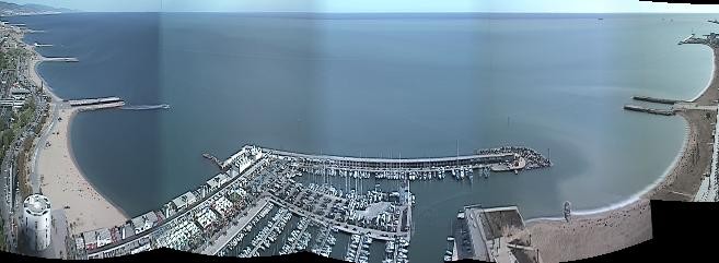 Pan View
|
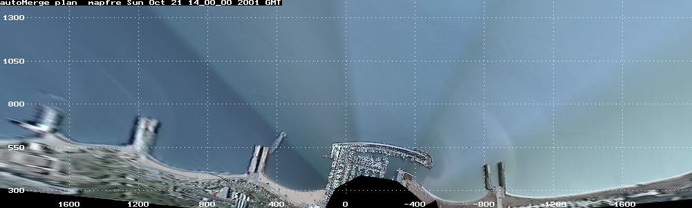 Plan View
|
Before May 25, 2015 there was an old videomonitoring system. Below the link to see the images: